Imágenes de antes y después del Terremoto y Tsunami de Japón de Google Earth

// Set the container's size to the size of the image $(this).width($(this).find("img[rel=before]").attr("width")).height($(this).find("img[rel=before]").attr("height"));
// Convert the images into background images on layered divs $(this).append("
").find(".after").css({"background": "url(" + $(this).find("img[rel=after]").attr("src") + ")", "width": $(this).find("img[rel=after]").attr("width") + "px", "height": $(this).find("img[rel=after]").attr("height") + "px"}); $(this).append("
").find(".before").css({"background": "url(" + $(this).find("img[rel=before]").attr("src") + ")", "width": $(this).find("img[rel=before]").attr("width") - 40 + "px", "height": $(this).find("img[rel=before]").attr("height") + "px"});
// Add a helpful message $(this).append("
Beweeg over de foto om voor/na te zien
");
// Remove the original images $(this).find("img").remove();
// Event handler for the mouse moving over the image $(this).mousemove(function(event){
// Need to know the X position of the parent as people may have their browsers set to any width var offset = $(this).offset().left;
// Don't let the reveal go any further than 50 pixels less than the width of the image // or 50 pixels on the left hand side if ((event.clientX - offset) < ($(this).find(".after").width() -30) && (event.clientX - offset) > 30) { // Adjust the width of the top image to match the cursor position $(this).find(".before").width(event.clientX - offset); } });
// Fade out the help message after the first hover
$(this).hover(function(){
$(this).find(".help").animate({"opacity": 0}, 400, function(){ $(this).find(".help").remove(); });
});
});
});
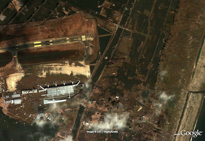
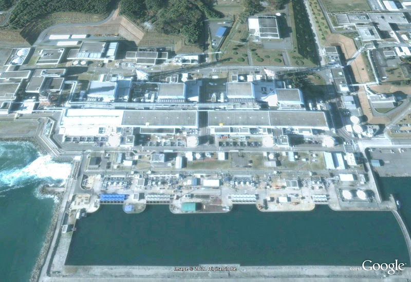
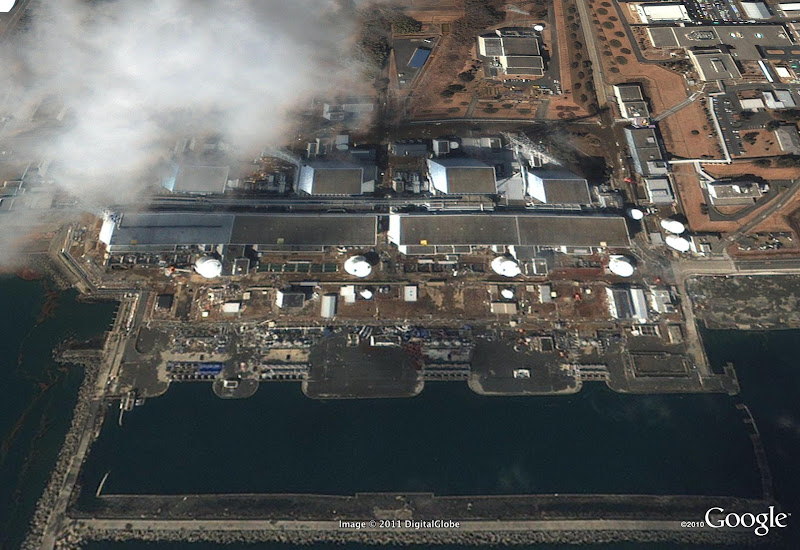
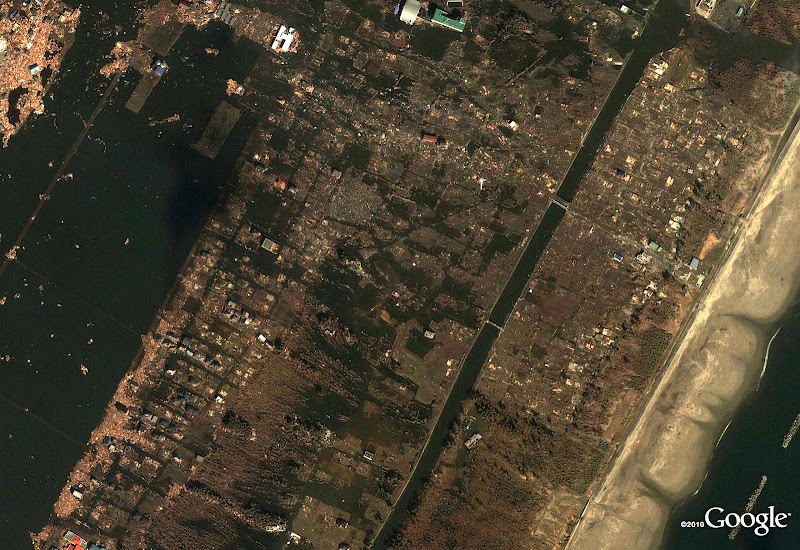
Google ha puesto su tecnología de fotos por satélite usada para Google Earth para que todos los Internautas puedan ver los problemas que ha ocasionado el terremoto de Japón y su posterior Tsunami.
Desde frikipandi nos sumamos al duelo por las victimas de esta catástrofe.
Las fotos aéreas tomadas en Japón han revelado la magnitud de la devastación a través de docenas de suburbios y decenas de miles de casas y negocios. Las victimas y damnificados no paran de crecer. 82 horas después del terremoto que sacudió Japón y provocó un brutal tsunami, el país nipón comienza las tareas de rescate con la ayuda de 100.000 militares, voluntarios de 70 países e incluso un portaaviones del Ejército estadounidense.
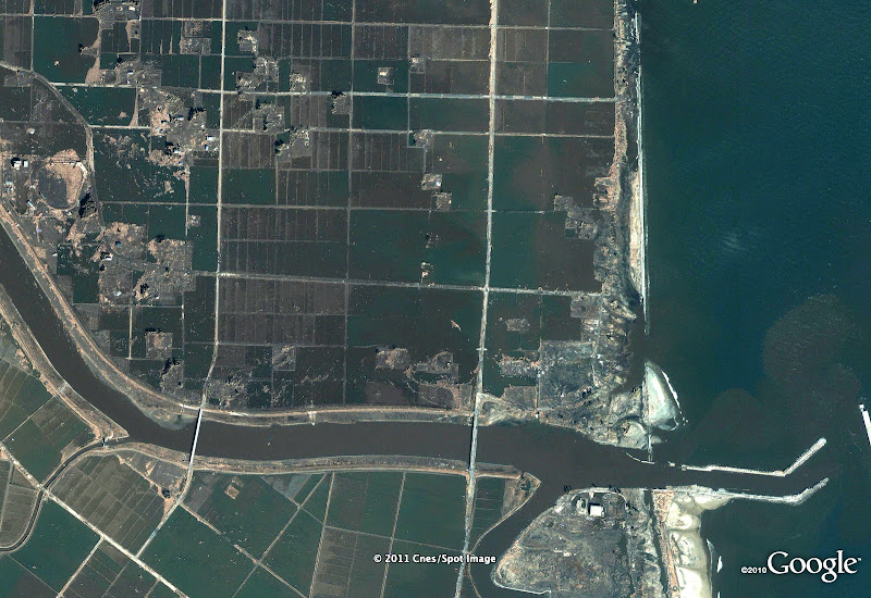
Pase el ratón sobre cada foto de satélite para ver la devastación causada por el terremoto y el tsunami. El origen de las fotos es un Albún Picasa de Google
Imágenes de antes y después del Terremoto y Tsunami de Japón de Google Earth
Sendai Airport
© Google, Digital Globe, GeoEye

Fukushima nuclear plant
© Google, Digital Globe, GeoEye
Arahama in Sendai
© Google, Digital Globe, GeoEye

Fujitsuka in Sendai
© Google, Digital Globe, GeoEye
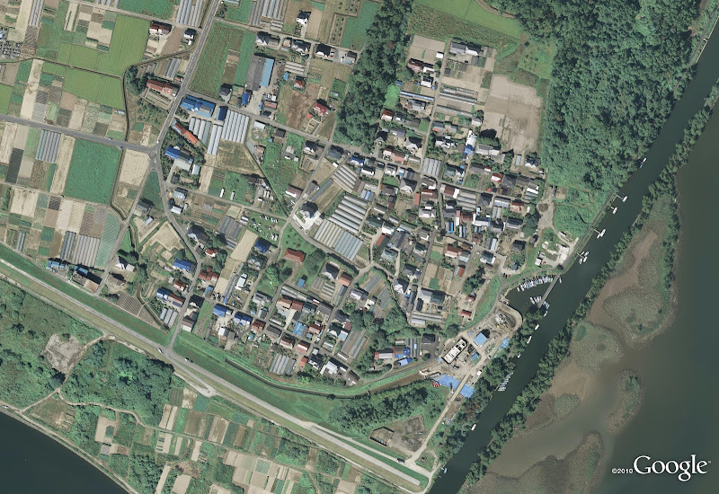
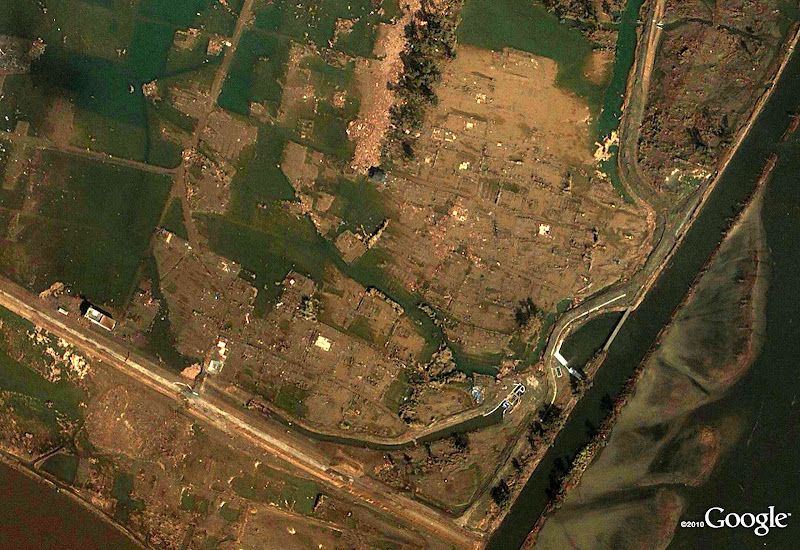
Yuriage in Natori
© Google, Digital Globe, GeoEye


Yuriage in Natori
© Google, Digital Globe, GeoEye


Kashimaku in Minamisoma
© Google, Cnes/Spot Image, GeoEye

Google pone a disposición de los usuarios de Internet la página Person Finder (http://japan.person-finder.appspot.com/ con el objetivo de ayudar a encontrar a personas desaparecidas en el terremoto y posterior tsunami ocurridos en Japón. Además de centralizar todos los recursos en http://www.google.com/crisisresponse/japanquake2011.html
Mediante esta plataforma, los usuarios podrán buscar el nombre de la persona desaparecida en la base de datos de Person Finder, creada por los mismos usuarios, o dejar información sobre su situación. Otro uso de la tecnología a favor de la humanidad.
Otras empresas de sector tampoco se han queda atrás. Apple desde iTunes ha puesto la posibilidad de donar dinero y Microsoft ha publicado una página como Google y dice que también dará licencias temporales a todos los clientes afectados y los socios, así como a los gobiernos e instituciones involucradas en los esfuerzos de respuesta al desastre de terremoto y posterior Tsunami en Japón.
. Leer artículo completo en Frikipandi Imágenes de antes y después del Terremoto y Tsunami de Japón de Google Earth. Frikipandi – Web de Tecnología – Lo más Friki de la red. Web de Tecnología con las noticias más frikis de Internet. Noticias de gadgets, Hardware, Software, móviles e Internet. Frikipandi


